Our six-part series will explore the local impacts of the climate crisis and offer ways we can meet this moment with urgency and bold action
Published June 28, 2021
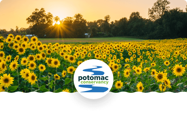
Rising to the Challenge
A New Climate Reality in the Potomac River Region
Uncovering our local climate story together
The health of our families, communities, and future generations depends on what we do today to create a more hospitable, safe, and life-sustaining tomorrow.
A clean and thriving Potomac River is a critical part of this future. Our region depends on the Potomac for the water we drink, the food grown on its lands, the air we breathe from its forests, and our physical and mental well-being from enjoying time spent outdoors.
Our six-part series investigates how the changing climate is impacting the Potomac River region and will answer:
How are we uniquely experiencing a warming climate compared to global trends?
How is the climate crisis affecting the Potomac River and its people, streams, lands, and wildlife?
What measures must be taken to lower greenhouse gas emissions and prepare communities for the future?
What can we do to be a part of the solution in our communities?
After conducting interviews with community members and experts, and carefully analyzing credible scientific studies, our research points to clear evidence that global and regional temperatures are rising at an alarming rate and only bold and immediate actions will save us from the worst-case scenarios.
The Potomac River region is experiencing hotter temperatures, warming and rising waters, and more extreme weather patterns. These increasingly hostile conditions are leading to a dangerous rise in illness, polluted runoff, poor air quality, stressed species, and costly property damage.
But there’s hope yet.
Overcoming the crises of the Ozone hole, dust bowl, acid rain, and other human-made catastrophes has taught us that when urgency is met with strong, collective willpower – communities can come together to solve big problems and leave a better future for the coming generations.
Our six-part series will explore local climate impacts – not with the intention of feeding into fear or anxiety – but to focus on solutions and challenge us all to meet this moment with urgency and bold action.
Fun fact: Scientists can identify increases in atmospheric carbon dioxide are, indeed, human-made because carbon created by burning fossil fuels has a different isotopic ratio of heavy-to-light carbon atoms than carbon produced naturally by living plants.
Fun fact: While carbon dioxide is the main culprit, other gasses like methane and nitrous oxide also add to the atmospheric soup of heat-trapping greenhouse gasses. Methane is released from natural gas fracking, the decay of organic waste put in landfills rather than composted, and from livestock and industrial agricultural practices. Nitrous oxide is released during fuel combustion and during the application of fossil-fuel based fertilizers or un-composted manure to fields (U.S. Environmental Protection Agency, 2020a).
In 2015, the ATMOS Research and Consulting for Kleinfelder published local climate projections by studying historic emission and temperature data at three District sites: Dalecaria Reservoir, the National Arboretum, and Washington National Airport.
Andrew Elmore co-authored a study on the warming waters of the Chesapeake Bay for the University of Maryland Center for Environmental Science.
Fun fact: Scientists can use high resolution climate models to tell whether an extreme event was made more likely by climate change – whether it served as a key ingredient in the storm’s formation. This is called “extreme event attribution.”
Fun fact: A rainfall event that is so heavy and unordinary that it only statistically happens once every 100 years
The National Weather Service confirmed an EF0 tornado touched down in Washington, DC and an EF1 tornado touched down Arlington, VA on Thursday, July 1, 2021. The nation’s capital has only experienced three confirmed tornadoes above an EF0 level in the last fifty years (two of which occurred on the same day in 2001).
FACT: According to the U.S. Geological Survey (USGS), glaciers and ice sheets store enough water to raise sea level by about 68 to 70 meters (223 to 230 feet) (Cronin, n.d.).
Thermal expansion is the phenomenon whereby the upper layer of the ocean absorbs heat from the warming atmosphere and expands
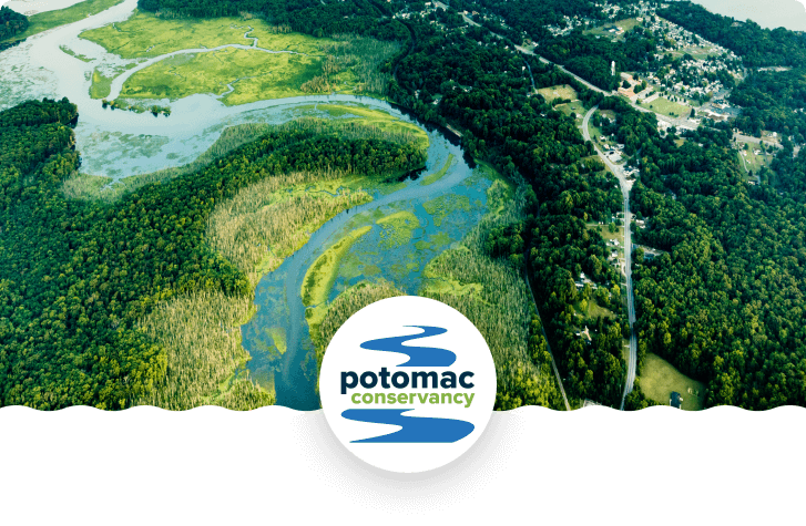
Over 400 miles in length, the Potomac River flows with fresh water from the highlands of West Virginia downstream to Washington, DC where it mixes with brackish saltwater and continues on to the Chesapeake Bay, the largest estuary in the world. The Potomac experiences daily low and high tides as far upstream as Washington, DC.
One such effort is underway in Washington, DC where tunnels are being constructed underneath the city’s rivers to divert excess rainwater and reduce sewer overflows into local streams. As part of the $2.7 billion Clean Rivers Project, DC Water has built a 5-mile long tunnel under the Anacostia River with plans to start building another one under the Potomac River in 2023. The plan also includes investments in tree plantings, rain gardens, and other types of nature-based infrastructure.
Living shorelines are a type of nature-based infrastructure that incorporates indigenous vegetation, either alone or in combination with harder materials for structure and stabilization. They restore ecosystems that naturally withstand and recover from the flooding that has become more common because of rising seas, stronger storms and heavier precipitation. Further, living shorelines build habitats that sequester, or store, carbon. According to NOAA, “one square mile of saltwater marsh stores the carbon equivalent of 76,000 gallons of gas annually.
Extreme heat conditions are defined as weather that is much hotter than average for a particular time and place—and sometimes more humid, too.
The heat index is a measure of how hot it feels when relative humidity is factored in with the actual air temperature. Relative humidity is the percentage of moisture in the air compared with the maximum amount of moisture the air can hold. Humidity is an important factor in how hot it feels because when humidity is high, water doesn’t evaporate as easily, so it’s harder for your body to cool off by sweating.
Ozone (O3) is a highly reactive gas composed of three oxygen atoms. It is both a natural and a man-made product that occurs in the Earth's upper atmosphere
(the stratosphere) and lower atmosphere (the troposphere). Depending on where it is in the atmosphere, ozone affects life on Earth in either good or bad ways.
Stratospheric ozone is formed naturally through the interaction of solar ultraviolet (UV) radiation with molecular oxygen (O2). The "ozone layer," approximately 6 through 30 miles above the Earth's surface, reduces the amount of harmful UV radiation reaching the Earth's surface.
Tropospheric or ground-level ozone – what we breathe – is formed primarily from photochemical reactions between two major classes of air pollutants, volatile organic compounds (VOC) and nitrogen oxides (NOx). These reactions have traditionally been viewed as depending upon the presence of heat and sunlight, resulting in higher ambient ozone concentrations in summer months.
Ground level ozone is a secondary byproduct of a chemical relation between human-made nitrogen oxides (NOx) and volatile organic compounds (VOCs) in the presence of sunlight. Humans are producing an extra 24 million tons of NOX annually through combustion processes from vehicles, power plants, cement factories (which are located adjacent to many communities of color in the Potomac River region), and other industry.
Nutrients—primarily nitrogen and phosphorus—are essential for the growth of all living organisms in aquatic ecosystems. However, excessive nitrogen and phosphorus degrade water quality.
Both nitrogen and phosphorus feed algal blooms that block sunlight to underwater grasses and suck up life supporting oxygen when they die and decompose. These resulting "dead zones" of low or no oxygen can stress and even kill fish and shellfish. Algal blooms can also trigger spikes in pH levels, stressing fish, and create conditions that spur the growth of parasites.
The incubation period is the number of days between when you're infected with something and when you might see symptoms. Health care professionals and government officials use this number to decide how long people need to stay away from others during an outbreak.
Coal ash, also referred to as coal combustion residuals or CCRs, is produced primarily from the burning of coal in coal-fired power plants.
Coal ash contains contaminants like mercury, cadmium and arsenic. Without proper management, these contaminants can pollute waterways, ground water, drinking water, and the air.
A Superfund site is an abandoned toxic waste site (usually that once supported an oil refinery or smelting or mining activities). In response to attention on sites like these in the late 1970s, Congress established the Comprehensive Environmental Response, Compensation and Liability Act (CERCLA) in 1980.
CERCLA is informally called Superfund. It allows EPA to clean up contaminated sites. It also forces the parties responsible for the contamination to either perform cleanups or reimburse the government for EPA-led cleanup work.
When there is no viable responsible party, Superfund gives EPA the funds and authority to clean up contaminated sites.
Frontline communities are those that experience “first and worst” the consequences of climate change. These are communities of color and low-income, whose neighborhoods will be increasingly vulnerable as our climate deteriorates.
Adaptive capacity is the ability of a habitat to support its species and ecosystem functioning as the climate changes. Plants and animals respond to changing climate by adapting, shifting their range, or fleeing completely.
Species that reproduce quickly are able to adapt or migrate more readily than slower growing, long-lived. species – like Maryland’s bald cypress that regularly lives up to 600 years.
Agriculture, development, and past logging operations played a large role in the large-scale loss of eastern hemlock throughout the Appalachian region.
Indigenous to East Asia, the fast-spreading hemlock woolly adelgid insect attaches to the soft, woody plant tissue and sucks nutrients from the sap of eastern hemlocks. Once the insect establishes a population on a hemlock, it can kill the tree within four years. Click on the link to read more about the pesky adelgid.
Coldwater streams make up approximately 2,750 miles of Maryland’s freshwater streams, spanning across Allegany, Garrett, Frederick, Carroll, Washington, Montgomery, and Prince George’s counties. In West Virginia, coldwater streams are found chiefly in the eastern panhandle. In Virginia, coldwater streams meander through the mountains and valleys of the Interstate 81 corridor, stretching across Augusta, Rockingham, Shenandoah, Warren, and Frederick counties up through Berkeley County in West Virginia.
Rainbow trout from the western U.S. and brown trout from Europe were introduced to the region in the late 1800s. They have slightly higher temperature tolerances and, once temperatures reach 68°F, they can out-compete indigenous brook trout. Elimination by competition is already occurring in some streams.
Fun fact: Salamanders are ectotherms, meaning they regulate their body temperatures through their environment. They sun themselves on rocks to warm up and cool off in streams or shaded areas.
Salamanders prefer temperatures between 33°F and 60°F. Their metabolism and heart rate slows when temperatures reach 50°F to survive more extreme conditions.
The opportunity to roam for resources is an important need for animals’ adaptive capacity in the fight against environmental changes.
NatureServe based its research on data from a weather station in Rock Creek Park and then used an ensemble of global climate models from the IPCC’s 5th Assessment Report to project near-future climate conditions in the Park.
In slightly salty oligohaline marshlands, salinity ranges from 0.5- 5 parts per thousand (ppt).
Visit Dyke Marsh or Mattawoman Creek to venture through two of our region’s freshwater marshes, areas of the Potomac River with salinity ranging from 0-0.5 parts per thousand (ppt).
According to a 2016 study in PLoS One, this edge might only be pushed up as far as Indian Head by the end of the century due to the region’s topography and the potential for water to spill out cross-sectionally (widening the river), rather than being pushed far upstream (Cadol et al., 2016).
Visit The American Scientist’s “Spring Budburst in a Changing Climate” for more information on how a warming climate is throwing off the timing of spring. The authors use Henry David Thoreau’s 160-year-old field notes to compare the timing of spring activities between then and now.
Roosevelt Island was transformed back into a “real forest” in the 1930s to mimic the natural ecosystems that covered the landscape before settler-colonial interference. Learn how this island has been transformed time and again – including how it was used as a place of refuge by people who were enslaved.
Source: University of Maryland Center for Environmental Science, 2015; Ding & Elmore, 2015.
www.umces.edu
The Maryland Commission on Climate Change, the Department of the Environment’s Scientific and Technical Working Group (STWG).
Every community produces polluted runoff – a type of pollution caused when excess rainwater carries toxins, debris, and litter into nearby streams – but the issue is particularly problematic on farmland. In fact, agricultural runoff is the greatest source of pollution to our region’s waterways. Poor land-use practices on farmland pollute streams with excess nutrients from fertilizers, pest treatments, and animal feces.
In 2018, the United States’ agricultural activity alone emitted approximately 698 million metric tons of greenhouse gasses into the atmosphere: 12.3% as carbon dioxide, 36.2% as methane, and 51% as nitrous oxide (U.S. Department of Agriculture, 2020).
Nitrous oxide is 298 times more potent than carbon dioxide over one hundred years, and is produced as microbes in the soil break down fossil-fuel based synthetic fertilizers and manure that hasn’t been aged or composted before being applied to fields.
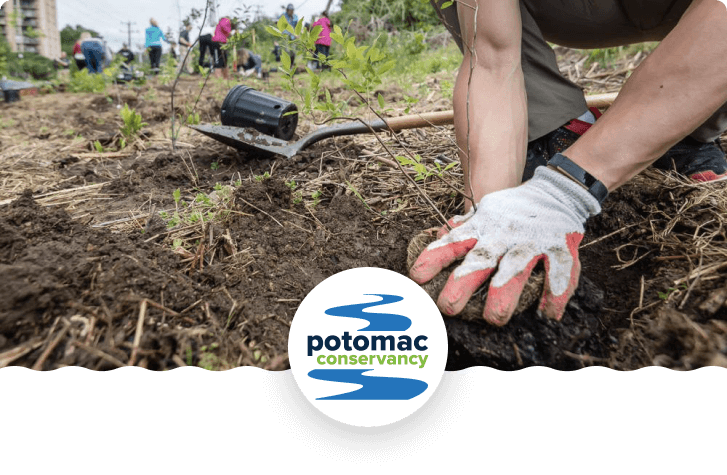
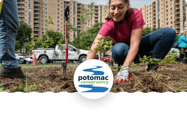
Best management practices (BMPs) are conservation measures that improve land health and prevent or mitigate pollution through natural means. BMPs are critically important to restoring water quality in the Potomac River region. Potomac Conservancy helps connect area landowners to available resources to implement BMPs on residential properties with a focus on family-owned farms in the headwaters region.
Learn more at www.potomac.org/lands.
TEK refers to the ever-evolving wisdom gained by indigenous and locally rooted peoples over hundreds of years by means of direct contact with their environment. The U.S. Fish and Wildlife Service explains that, “this knowledge is specific to a location and includes the relationships between plants, animals, natural phenomena, landscapes, human beings, and timing of events that are used for lifeways,” like agriculture or hunting and trapping (Rinkevich et al., 2011).
Source (Aman & Pratt, 2014).
Industrial farming that relies on growing expansive fields of one crop – corn, wheat, soy, as examples – planted year after year, drain the soil of essential nutrients and lack the genetic diversity to fight diseases and pests. Consequently, they require the help of artificial additives.
The Lacandon are the last of the Mayans who escaped the Conquistadors’ forced Christianity by hiding in the heart of the jungle. For the last five hundred years, the Lacandon lived very simply and have kept their borders closed to outsiders. Their population consists of about six or seven hundred people now.
Earthaven Ecovillage is a permaculture community outside of Black Mountain, North Carolina that applies Traditional Ecological Knowledge.
Take action title
Plus a short introduction or description far far away, behind the word mountains, far from the countries Vokalia and Consonantia, there live the blind texts. Separated they live in Bookmarksgrove right at the coast of the Semantics.
Download the complete Potomac Conservancy 2021 Climate Report PDF
Plus a short introduction or description far far away, behind the word mountains, far from the countries Vokalia and Consonantia, there live the blind texts. Separated they live in Bookmarksgrove right at the coast of the Semantics.
Get updates for new chapters of the Potomac Conservancy 2021 Climate Report.
Plus a short introduction or description far far away, behind the word mountains, far from the countries Vokalia and Consonantia, there live the blind texts. Separated they live in Bookmarksgrove right at the coast of the Semantics.
Demand urgent climate solutions to protect clean water and healthy families!


 Published June 28, 2021


 Press/Media